Glacier 2024 — Many Glacier and the East
US Highway 2 and Middle Fork Flathead River, east of Nyack, MT, with the Lewis Range visible in the distance.
We made our way over to the east side of Glacier National Park via US Highway 2. We stayed in a cabin at the KOA in Saint Mary and made two trips up to Many Glacier. Then we made our way back west the next day on Going-to-the-Sun Road, which was a really fun experience coming from the other side.
This has to be the only zebra in Montana, right? … right?!
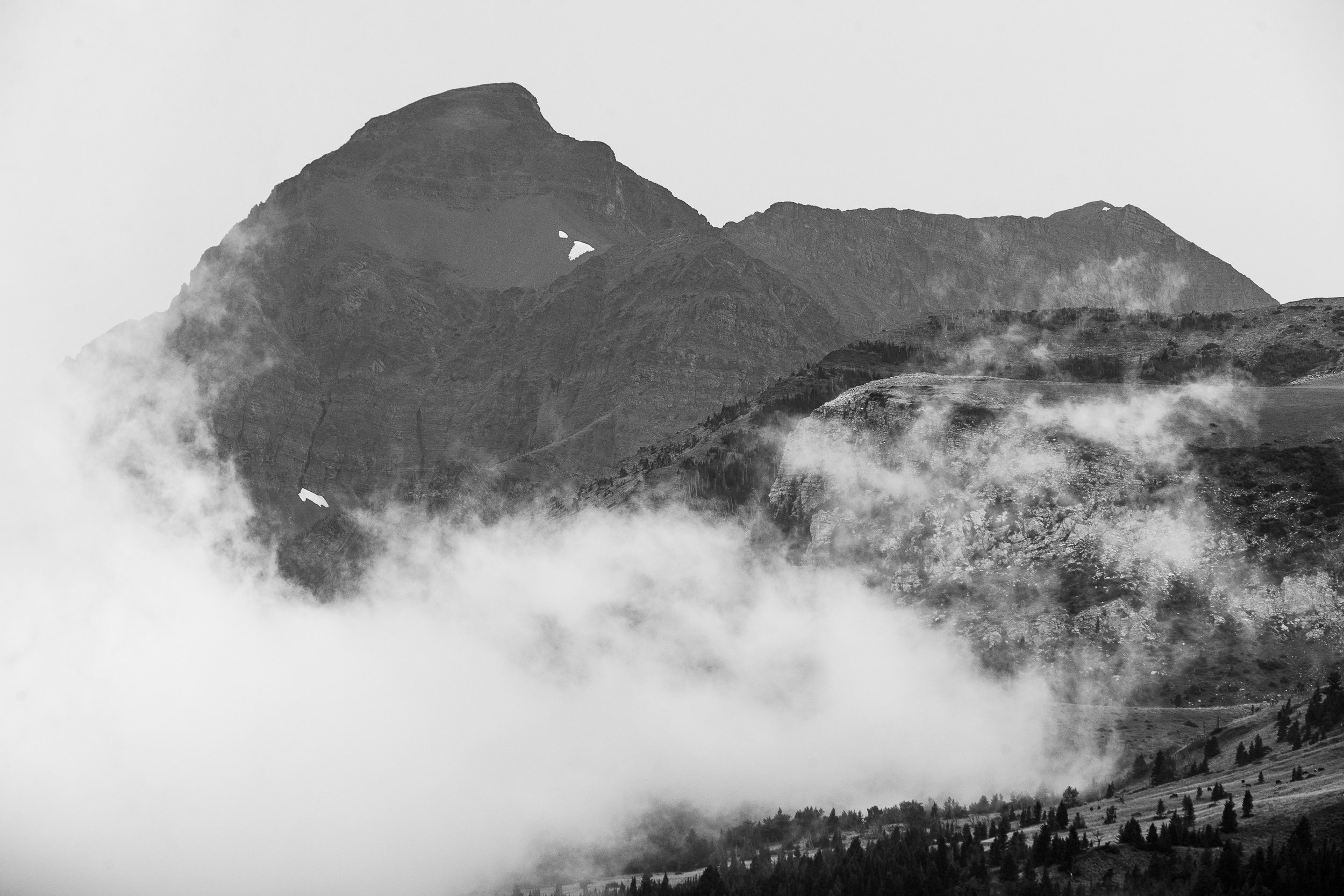
We saw a whole lot of these low clouds on the east side of the park. This shot of Mount Henry (I believe) is taken from Looking Glass Hill, just north of Lower Two Medicine Lake.
This osprey was a delightful discovery. At times, it felt like he was looking at me. He probably saw me long before I saw him, if I’m being honest.
I nearly missed him picking up the fish.
He was quite far away before looping around and landing on some unseen tree.
A horseback tour of Many Glacier definitely went onto my bucket list after seeing these guides riding past Mount Wilbur.
A kind stranger got us in front of Grinnell Point while the boys waited patiently in the car.
Wild Goose Island on Saint Mary Lake at blue hour, conveniently located just a quarter of an hour away from our KOA cabin in Saint Mary.
Our first day in the east was covered in clouds and a fair bit of rain. After some expensive (but delicious) pizza and a few hours of rest, we were up and heading to see the sun rising over Many Glacier. It proved to be a much clearer day.
The first rays of light hitting Grinnell Point above Swiftcurrent Lake, moments before the wind picked up and made this reflection go away. (And before that happened, I was actually disappointed with how much movement was in the water. I’m glad I shot it anyway.)
The sunrise was absolutely blazing; its warmth undeniable.
Mount Gould and Angel Wing at sunrise from Swiftcurrent Lake.
Swiftcurrent Mountain at sunrise over Swiftcurrent Lake.
Mount Wilbur (right) sits above Swiftcurrent Mountain (left) at sunrise.
There were very few people around at this time, and everyone there was busily snapping away photos of this sunrise light, so we opted for a selfie. How do you like my mountain hat?
I could not get enough of this light. These falls on Swiftcurrent Creek provided a nice foreground.
Swiftcurrent Creek snakes through the valley below Wynn Mountain.
Altyn Peak (left) and something unknown (right) with Apikuni Mountain in the background between them.
Maggi easily jumped above Apikuni Mountain. Her cheerleader days serve her well.
I wandered across the road and then turned around to catch her finding her own shot.
This is Maggi’s version of the scene above.
We reconvened for a selfie in front of Altyn Peak before moving on.
At this point, it was time to go look for the bears of Darius’s dreams. I spoke with a park ranger the day before and he told me they are often seen in the meadow by Windy Creek. (And is that win-dy or whine-dy?) We had two hours before we needed to leave for the cabin and pack up all of our stuff, so I was determined to wait it out. As it happens, we pulled up and found one other vehicle stopped and clearly looking at something. They told us they had spotted some bears. No waiting required!
Before the bears emerged from behind the bushes, I got a shot of this yellow bird. I am told that every man becomes a birdwatcher at some point—it’s only a matter of time.
But then the bears made their appearance—a mama black bear with two cubs.
They’re communicating!
The park ranger told me they need to eat up to 20,000 calories a day to prepare for hibernation.
This is probably the moment when I should have realized we were too close. The park rangers came by shortly after this and told us we were too close, so everyone dispersed.
Everybody was riding high after seeing the bears.
Lake Sherburne features somewhat prominently in this photo, and I wish I had time to annotate all of the mountains in this shot, but that would require a lot of research and I’ve already spent way too much time on this post.
I thought this was a perfectly nice photo of Swiftcurrent Creek, but Maggi wanted me to shoot video (see below).
We went back to the cabin to pack up, and we had some extra time with the conveniently early bear sighting, so the boys had time to play with the bunk beds as fire trucks.
After checking out, we started the journey west on Going-to-the-Sun Road.
A few green trees attempted to hide over 4,000 acres along the northwest shore of Saint Mary Lake that were consumed by the Reynolds Fire in 2015. It was discovered July 20, brought under control September 27, and finally extinguished November 23.
A nice waterfall in the distance, near Logan Pass. I believe this water is part of Reynolds Creek.
And here is Clements Mountain above Logan Pass.
Maggi was enjoying the waterfalls. The one behind her belongs to Lunch Creek, if I am understanding the maps correctly.
Just beyond Logan Pass, we found this cloud hugging Mount Oberlin.
And finally, a shot of Heavens Peak mingling with the clouds.
We owe an incredible debt of gratitude to Austin & Esther for hosting us half the time we were in the area (although as far as Darius and Torin were concerned, it was “Olivia’s house”). And of course Mac was quite welcoming, not to mention fluffy. (They’re good dogs, Brent.)
We also discussed the above on episode 40 of Adventures with BAM.


